- A US government agency cut off Ukraine from high-resolution satellite imagery.
- A drone operator told BI that Maxar’s images are essential to flying in GPS-jammed areas.
- Maxar’s imagery, in particular, helps his unit find and hit Russian targets.
The commercial satellite imaging company Maxar confirmed that it is suspending the sharing of US government-commissioned imagery with Ukraine, a move that severely constrains Ukrainian drone pilots trying to defend their homeland.
This latest move is part of the Trump administration’s drastic freezing of US aid and intelligence support to its ally. It will severely hamper how drone pilots can target Russian forces or spot their movements, a pilot told Business Insider. The widespread jamming of GPS navigation has forced Ukraine’s drone pilots to rely on high-resolution imagery, particularly that produced by Maxar.
Maxar told BI on Friday that the US government had suspended Ukrainian accounts in the Global Enhanced GEOINT Delivery program, or GEGD, a major government portal for sharing government-purchased imagery with allies.
Maxar is contracted with the National Geospatial-Intelligence Agency (NGA) on the program. The NGA told BI that it had “temporarily suspended” access “in accordance with the Administration’s directive on support to Ukraine.”
The change hinders Ukraine’s awareness of the Russian forces behind the frontlines and obstructs their deep strike campaign that has targeted Russian supply lines and ammunition depots, said Dimko Zhluktenko, who works in Ukraine’s Unmanned Systems Forces, said.
The move, first reported by Ukrainian outlet Militarnyi on the basis of unnamed sources, comes just after the US announced it was pausing its intelligence sharing with Ukraine and days after President Donald Trump announced an indefinite pause in US aid to Ukraine, leaving the future of a major weapons source in doubt.
Much like Starlink, the SpaceX internet satellite service provided to Ukraine through US government contracts, commercial satellite images are essential to the planning and execution of Ukraine’s military operations.
Zhluktenko said that Ukraine’s Unmanned Systems Forces, a branch that specializes in drone operations, relies more heavily on satellite imagery from private companies like Maxar than it does on intelligence given directly by the US government.
Without Maxar imagery, “deepstrike drone operators will not get as precise targeting,” Zhluktenko told BI.
“Intelligence services will have worse understanding of Russian stockpiles and repair factories” and have “a worse understanding of how much capacity Russia has left.”
He said that his unit often used Maxar satellite imagery to plan reconnaissance drone missions, to find deep strike targets and places where Russia was storing equipment like tanks and vehicles, and to see the results of those deep strikes.
Maxar Technologies
Zhluktenko said Ukrainian soldiers use a mix of different satellite imagery companies, but that Maxar stood out because of the quality of its images. He estimated that 75% of the units that use drone imagery largely rely on Maxar specifically because “high-quality satellite images and maps are a must.”
In addition to its assistance to Ukraine, the company’s images have widely documented the changes and damage occurring during the war.
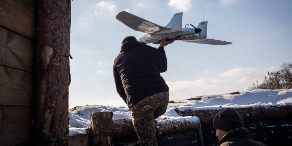
Drones have become an increasingly important part of Ukraine’s fight back against Russia’s invasion. Ukraine can make drones itself, whereas its supply of Western aid, while large, has often come with conditions or delays and has an unclear future.
Across the 600-mile stretch of the frontlines, drones have taken on the roles of anti-tank missiles and other weaponry. Even cheap drones have hit far behind Russia’s lines, destroyed pieces of equipment worth millions, and contributed strongly to Ukraine holding Russia back. The USF, set up in 2024, is considered the world’s first military branch devoted solely to drone warfare.
Ukraine’s drone units as of last November accounted for at least 80% of Russian frontline losses, The New York Times then reported.
That means weakening Ukraine’s drones — particularly at the same time that aid from the US is paused — could have a major impact on the battlefield. This effect gets more pronounced as the imagery stoppage continues, allowing Russia to mass forces for assault with a lower chance of being spotted.
And Ukrainian drone units have become increasingly reliant on satellite imagery as a way to get around Russian jamming.
Miguel Candela/SOPA Images/LightRocket via Getty Images
Zhluktenko said that using GPS is impossible in heavily contested areas as jamming efforts are so high.
In place of locating with GPS, drone operators increasingly orient themselves by comparing the drone camera’s view to maps and satellite images, Zhluktenko said. In this way, Maxar technology helps them “navigate the battlefield.”
Ukraine has been developing drones that work along these lines — with software that compares what the drone sees to photos and video of the area that was previously captured — to get around Russian jamming.
American company Vermeer announced last month that it was integrating its technology into Ukrainian drones. This technology preloads satellite images onto drones so they don’t need to rely on GPS.
Zhlutenko said the Trump administration’s actions are making Ukraine weaker and could be used against other US allies.
In 2023, the NGA awarded Maxar a five-year, $192 million contract which would help provide US allies with imagery “consisting of high-resolution electro-optical, synthetic aperture radar (SAR) and 3D data products,” the company announced.
The Trump-ordered intelligence freeze may have most immediate impact by limiting the effectiveness of Ukraine’s air defenses, which are improved by early warning sensors.
The longer the US intelligence hold continues, and its military risks mount, the more likely it is that Ukraine will have to make do with commercial satellite imagery firms outside the US and rely on other types of sensors like high-altitude drones.
But losing Maxar, and US intelligence more broadly, is a deficit all of that tech could not easily replace.
