


subscribers. Become an Insider
and start reading now.
Have an account? .
- The massive blizzard slamming the Northeast is visible from space.
- A National Oceanic and Atmospheric Administration satellite photographed the swirling winter storm.
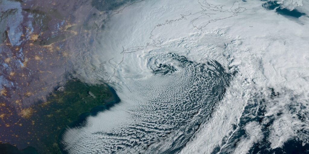
- Satellite images showed the comma-shaped clouds characteristic of nor’easters.
The National Oceanic and Atmospheric Administration’s GOES-19 weather satellite captured striking photos of the powerful winter storm slamming much of the Northeastern US on Monday.
A satellite photo taken at 7:40 a.m. ET showed the storm intensifying over the Atlantic Ocean as the sun rose over the East Coast.
CIRA/NOAA
Another satellite image taken at 10:31 a.m. ET showed the blizzard’s comma-head cloud shapes, characteristic of nor’easters.
CIRA/NOAA
The National Weather Service reported winds of 40 to 70 miles per hour across the Northeast, with snowfall rates of over 2 to 3 inches per hour. Some areas were forecast to receive over 2 feet of snow.
Over 9,000 flights have been canceled since Sunday. As of noon ET Monday, more than 600,000 homes and businesses were experiencing power outages, including 410,000 in Massachusetts and New Jersey.
With the views of the winter storm from space, it’s clear to see why.